Working with Map Settings
You can use the Map Settings fly-out menu to control how the GAP Portal map is displayed. It's also how you access various tools to help you in your use of the map.
To access the Map Settings fly-out menu, click on the "hamburger" icon on the top left-hand side of the ma
Tools Tab
The Tools tab contains various tools and utilities, including:
- Search Map Location - adds a search box allowing you to search for particular places (i.e. latitude / longitude co-ordinates, towns, cities, countries, monuments, shops, etc.)
- Slide Time Filter - adds a slider allowing you to filter devices shown on the map by the time they last reported
- Measure Distance - adds a tool allowing you to measure the distance along a set of points
- Time Information - allows you to drop a pin on a map and display the current time at that location
Map Types Tab
The Map Types tab allows you to change the type of map displayed, options include:
- ESRI
- Google (requires license - contact us for more information)
- Open Street Map
Overlays Tab
The Overlays tab allows you to control what map overlays are displayed. You can also choose to display geofences, points of interest and any KML layers you may have set up.
Weather Tab
The Weather tab allows you to add weather overlays to the map such as those below:
- Temperature
- Precipitation
- Wind Gusts
- Cloud Cover
- Pressure
- Humidity
- Dew Points
- Snow Accumulation
- Heat Index
- Jet Stream (250mb)
- Tropical Storms
- Air Quality
- Radar
- Storm Cells
- Lightning Strikes (last 15 minutes)
- Sea Surface Temperatures
- Wave Heights
Note: some overlays may cover only some parts of the world. Please contact us for more information.
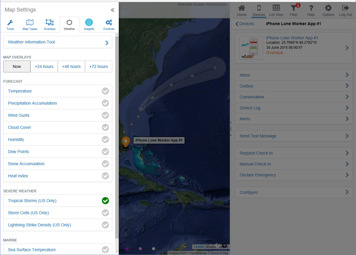
Some maps allow you to use the time control to show forecast data for up to 3 days ahead.
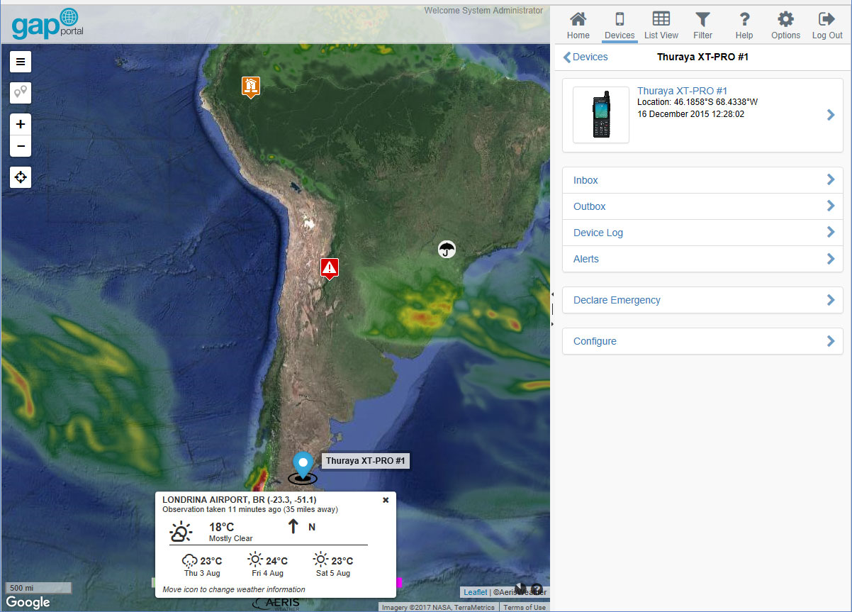
You can also use the Weather tab to access the Weather Information Tool. This tool allows you to drop a pin on the map and display the most recent weather observations and 3 day forecast from the weather station nearest to that location.
Note: If there is no weather station in the vicinity of the place where you have dropped the pin, a warning may be displayed indicating that no data has been found.
Controls
The Controls tab allows you to access additional map controls and tools, including:
- Zoom Buttons
- Map Scale
- Mini Map - displays a smaller map in the top right-hand corner at a lesser zoom level for providing context
- Edge Markers - display arrows pointing in the direction of nearby devices not shown in the current map view
- Mouse Position - dislays the current location (latitude / longitude) of the mouse pointer in various co-ordinate formats as well as the current UTC time and map zoom level
- Quick Zoom Button - zooms the map to the most approrpriate level to display all devices
- Refresh Timer - displays a countdown timer in the bottom right-hand corner of the map to show when the next refresh is due
- Grid - displays a latitude / longitude grid
- Day And Night - overlays a shadow showing where it is currently nighttime
- Feedback Button - displays a button allowing users to submit feedback
- Map Legend
Note: having a large number of map tools enabled may reduce performance on some older computers.